Projects
SARIF
The Forest Fire Risk Assessment System provides the thematic cartographic layers that allow the assessment of daily fire risk in Andorra.
Start date: 01/01/2013
 Anna Albalat
 Anna Echeverria
 Laura Trapero
 Marc Pons
Work strands:
Meteorology
Natural risks
Natural risks
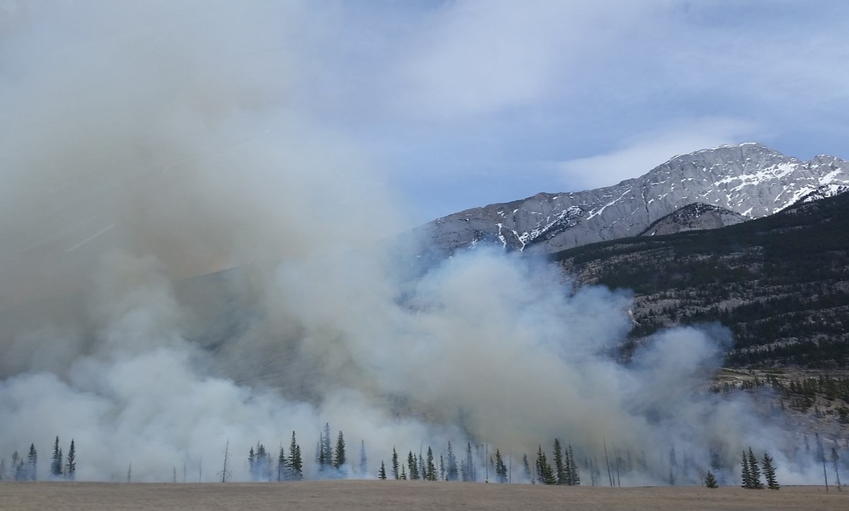
The Forest Fire Risk Assessment System (SARIF) provides the thematic cartographic layers that make it possible to assess the daily fire risk in Andorra. It should be noted that it includes the calculation of the Canadian Fire Weather Index, used in other fire risk assessment systems in the world. This index, based exclusively on meteorological data, provides information on the availability of vegetation to start and spread a fire. Other thematic layers of interest are the fuel map and the flammability and extinction difficulty map.
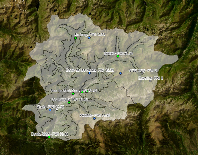
The Fire Weather Index (FWI) system makes it possible to determine the danger of a forest fire for a specific place and time, based on data from weather stations. Although this system is designed to determine the fire hazard in forests where coniferous fuels predominate. It has also been shown to be effective in determining the risk of fire in forests with various types of fuels. Currently, this system is used to assess the fire hazard of countries such as Canada, Australia or New Zealand.
The FWI is calculated from six components that consider the effects of fuel water content (grass, shrubs, trees, etc.) and wind on fire behaviour:
- Values on the water content of the fuel (Fuel moisture codes).
- Values on fire behaviour (Fire behaivour indices).
- Climatic variables of temperature, relative humidity, wind speed and precipitation.
The FWI system is not an indicator of changes in danger between hours, it does not take into account variations in fuel types between stations or places. The FWI gives us a daily value of the risk of fire at the highest risk peak (mid-afternoon with higher temperatures) with the measurements of climatic variables taken around 12 o'clock, solar time.
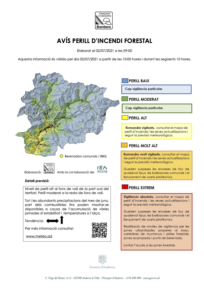
With the start of the forest fire campaign, Bombers d'Andorra and Protecció Civil presented the portal www.incendis.ad. The website developed by Andorra Research + Innovation and the Area de Cartografia del Govern, with the collaboration of the seven municipal administrations, responds to the tasks of prevention and emergency management carried out by this professional body.
The forest fire hazard warning bulletin is published only on days when the danger is high, and special surveillance and prevention is required by the entire population. It also includes all the information on the state of the picnic areas in the different villages of Andorra. You can check the location, opening status, conditions of use and information regarding access and recommendations. Finally, access to weather forecast information and a collection of recommendations and advice for the general population has been incorporated.